You come to Sedona for the red rocks and trail days, not to circle a packed lot or track dust through your foyer. Yet two homes that both claim “near trails” can offer very different lifestyles. The difference comes down to access, peak‑time patterns, and whether the property is set up for post‑hike living. In this guide, you’ll learn how to evaluate trail proximity, parking and permits, neighborhood dynamics, and home features that make hiking here easy. Let’s dive in.
Why hiking access matters in Sedona
Sedona sits within a dense network of day hikes across public lands managed by the U.S. Forest Service’s Red Rock Ranger District, the City of Sedona, and other agencies. Many sought‑after trailheads sit on Forest Service or city property. This is great for choice, but it also concentrates visitors at a few famous spots.
Visitor volume is strong year‑round, with spring and fall as the busiest seasons. Popular trailhead lots often fill early on weekends and holidays. That affects your daily rhythm if you plan to hike at sunrise or return at sunset.
Seasonal weather matters too. Summer’s monsoon season can bring afternoon storms and flash‑flood risk in canyons. Winter brings cooler temps and shorter days, and some exposed trails can be icy. Access rules can change with conditions, so expect occasional closures, fire restrictions, or special parking controls in high‑use periods.
Step 1: Map real routes and times
Measure the actual walk
Do not rely on straight‑line distance. Trace the safe pedestrian route to a trail entry, including sidewalks, shoulders, or neighborhood paths. A 5‑minute walk feels very different from a 15‑minute walk with elevation.
Walk the route at the times you plan to hike. Sunrise and sunset can be busiest at certain trailheads, so confirm how lighting and traffic feel in real life.
Test the drive at target hours
Short distances can take longer than you expect during peak seasons. SR 89A and SR 179 see heavy tourist traffic, so a 10‑minute off‑peak drive can stretch to 25–45 minutes at busy times. Do a test run on a weekday morning, a weekend between 7 and 10 a.m., and near sunset.
Use navigation apps with historical “popular times” to see typical congestion. Check how long it takes not only to reach the lot, but also to find a space or to pivot to a backup trailhead.
Consider bicycle access and safety
If you plan to bike to trailheads, inspect shoulder width, traffic speed, and elevation gain. Some corridors are narrow with frequent visitor traffic. Choose routes that feel safe in real conditions, not just on a map.
Check cell coverage and emergency access
Test signal strength at the property and at your target trailheads. Verify where the nearest fire and ambulance services are for the neighborhood and how they access your area in peak seasons.
Step 2: Verify parking, permits, and peak patterns
Know the parking setup
Ask whether the trailhead has a dedicated lot, paid parking, or street parking. Many popular lots have no overflow areas and fill early on weekends and holidays. Street parking near residential areas is often enforced.
Confirm permits and passes
Many Forest Service lots require a Red Rock Pass or other fee. Rules can shift with crowding. Before you buy, contact the Red Rock Ranger District to confirm the current requirements, seasonal programs, and any reservation or shuttle systems at very popular sites.
Track peak arrival times and seasons
Expect weekend and holiday crowds, with many lots filling by mid‑morning. Some trailheads peak at sunrise or sunset due to photography and view timing. Spring and fall run busiest overall, with summer afternoons drawing visitors to shaded canyon hikes.
Understand enforcement and neighborhood rules
The City of Sedona enforces parking rules near high‑use areas, and towing is not unusual where streets are signed. If you plan to host guests who hike, review HOA rules on guest parking, street parking, and short‑term rentals. Ask about any known enforcement patterns near the home.
Step 3: Match neighborhoods to your hiking goals
Iconic views and short hikes
If Cathedral Rock, Bell Rock, and similar landmarks are your priority, look at southern and southeast approaches and the Village of Oak Creek. You will trade quick access for higher visitor intensity at peak times. Visit at sunrise and sunset to see how it feels.
Canyon and creek experiences
For oak‑shaded canyon walks and access toward West Fork in Oak Creek Canyon, focus on homes closer to the canyon and the south valley. Be mindful of seasonal parking pressure and winter conditions.
Backcountry links and connectors
If you prefer multi‑trail days and a bit more space, consider areas with access to Schnebly Hill, Munds Wagon, or lesser‑known connectors. Farther from Uptown often means more driving but fewer peak‑crowd effects on your doorstep.
Airport Mesa and Uptown proximity
These areas place you close to viewpoints and moderate trails. They also see heavy tourist flow and limited parking during peak season. Check noise and parking spillover during busy weekends before you commit.
Visit at real times
Whatever area you like, return on a weekend morning, a weekday sunrise, and one sunset. Watch traffic, lot availability, and neighborhood parking behavior. Small patterns here can shape your daily routine later.
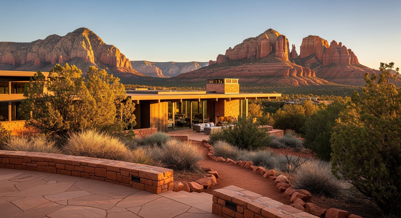
What to look for in the house
A hiking home is about more than proximity. Smart layouts and durable finishes preserve the luxury feel while making post‑trail life easy.
Interior layout and finishes
Look for a mudroom or gear room with a bench, hooks, and durable flooring such as tile or sealed concrete. A secondary entry near the garage lets you shed dusty layers before entering the main living areas. Extra laundry capacity and a utility sink help with frequent wash cycles.
Minimize carpet near entries and high‑traffic paths. Choose surfaces that clean quickly and resist abrasion.
Exterior rinse and storage
An outdoor rinse option near the back door or garage is a simple, high‑impact upgrade. A hose bib, foot‑wash, or hard‑plumbed outdoor shower keeps sediment outside. In the garage, seek built‑in shelving, bike mounts, overhead racks, and space for roof racks or longer gear.
Yard and landscaping
Low‑maintenance, permeable surfaces like gravel, decomposed granite, or pavers near entries reduce tracked‑in dust. Shade structures or covered patios help gear dry during summer heat. Maintain clear zones around the home to support fire‑defensible space.
Systems and utilities
Frequent showers call for robust hot‑water capacity. Tankless systems or larger tanks handle multiple back‑to‑back showers. If the property uses a well or septic, confirm capacity and recent service because guest loads can spike after hiking days.
Good ventilation and dehumidification protect gear from lingering moisture and odors.
Accessibility details
Ground‑level or low‑step showers are helpful if you plan to age in place. Non‑slip surfaces and gentle exterior slopes improve safety when returning with muddy soles.
Due diligence and risk checks
Wildfire risk and insurance
Ask for wildfire assessments and defensible‑space guidelines for the neighborhood. Fire restrictions can affect trail access during high‑risk periods, and insurance costs can vary by hazard ratings. Confirm what maintenance is required and how it affects premiums.
Water, septic, and guest loads
If you plan to host, verify well and septic capacity and any service history. High guest counts after trail days can increase water use and strain systems. Match equipment to your actual plans.
Roads, easements, and seasonal access
Confirm road maintenance responsibilities on private or unpaved approaches. Test drive in wet conditions during monsoon season if possible. Verify any gated access or easements, and ensure guests can reach the property within HOA rules.
Printable checklist for showings
Use this quick list on each tour to compare options.
Trail proximity and routes
- Which trailheads are a 5–20 minute walk along safe routes? Which require a drive?
- Are any nearby trailheads subject to seasonal closures or restricted access?
- What are the typical peak hours at those trailheads on weekends and holidays?
- Is street parking common nearby, and how is it enforced?
Parking, permits, and patterns
- Does the closest lot require a Red Rock Pass or fee? Confirm current rules with the Red Rock Ranger District.
- How often do lots fill at sunrise, mid‑morning, or sunset in spring and fall?
- Are there city or HOA restrictions on guest parking and short‑term rentals?
Property features for hikers
- Is there a mudroom or secondary entry with durable flooring?
- Are there outdoor rinse options and accessible hose bibs near entries?
- Is there garage storage for bikes, packs, and longer items like roof racks or kayaks?
- What is the hot‑water capacity and laundry setup?
Safety, access, and utilities
- How is cell coverage at the home and at your target trailheads?
- What are the nearest emergency services and typical response routes?
- What is the wildfire risk and defensible‑space expectation?
- For well or septic, what is the capacity and maintenance history?
On‑site verification
- Drive to your top trailheads at sunrise and sunset on both a weekday and a weekend.
- Walk the actual pedestrian route to a local access point.
- Look for signs of visitor spillover parking or trail users in residential streets.
Putting it all together
In Sedona, “near the trails” can mean a peaceful morning walk from your doorstep or a daily battle with full lots and overflow parking. When you evaluate a home, pair lifestyle goals with the realities on the ground. Map real routes and times, confirm permit and parking rules, then make sure the property supports how you live after the hike. With a disciplined approach, you can secure the views and access you want without sacrificing privacy or comfort.
If you are weighing properties across multiple micro‑areas, a local, boutique advisor can help you compare trail access patterns, HOA rules, and home features side by side. For a private, results‑driven strategy tailored to your hiking lifestyle, connect with St John International to Schedule a Private Office consultation.
FAQs
How busy are Sedona trailheads during peak season?
- Spring and fall are the busiest times, with many popular lots filling by mid‑morning on weekends and holidays. Sunrise and sunset can also see spikes at photo‑friendly locations.
Do Sedona trailheads require a pass or permit?
- Many Forest Service lots require a Red Rock Pass or fee. Because rules can change with crowding, confirm current requirements with the Red Rock Ranger District before you go.
What is the best way to test drive times to trailheads?
- Drive your route at sunrise, mid‑morning, and near sunset on both a weekday and a weekend. Use navigation apps with historical “popular times” to gauge typical congestion.
What home features help with post‑hike clean‑up?
- A mudroom with durable flooring, an outdoor rinse area, extra laundry capacity, and garage storage for bikes and packs keep dirt out and simplify daily routines.
How should I assess wildfire and insurance factors?
- Ask for wildfire risk assessments and defensible‑space guidance, then confirm insurance availability and premiums for the neighborhood. Requirements can affect both upkeep and cost.
What should I check about HOAs near trailheads?
- Verify guest and street‑parking rules, storage policies for gear or trailers, and any short‑term rental limits if you plan to host visitors or rent when not in residence.
Is biking to trailheads practical in Sedona?
- It depends on route safety and elevation. Inspect shoulder width and traffic patterns on your exact path, and choose times of day with lighter visitor flow when possible.